Survey, 2009-02-17, Pacific Ocean

Taiwan Strait 2009, western Pacific coastal water

A short February 2009 LIF LiDAR transect in the Taiwan Strait off south-western Taiwan, the company's only deployment in the western Pacific, extending the method to sub-tropical, sediment-influenced Case-2 coastal water far from its usual European and Arctic grounds.

Published figures

Interpolated fields from the campaign, reproduced as issued. Plate titles carry the LIFL-9 under its original designation, UFL-9.

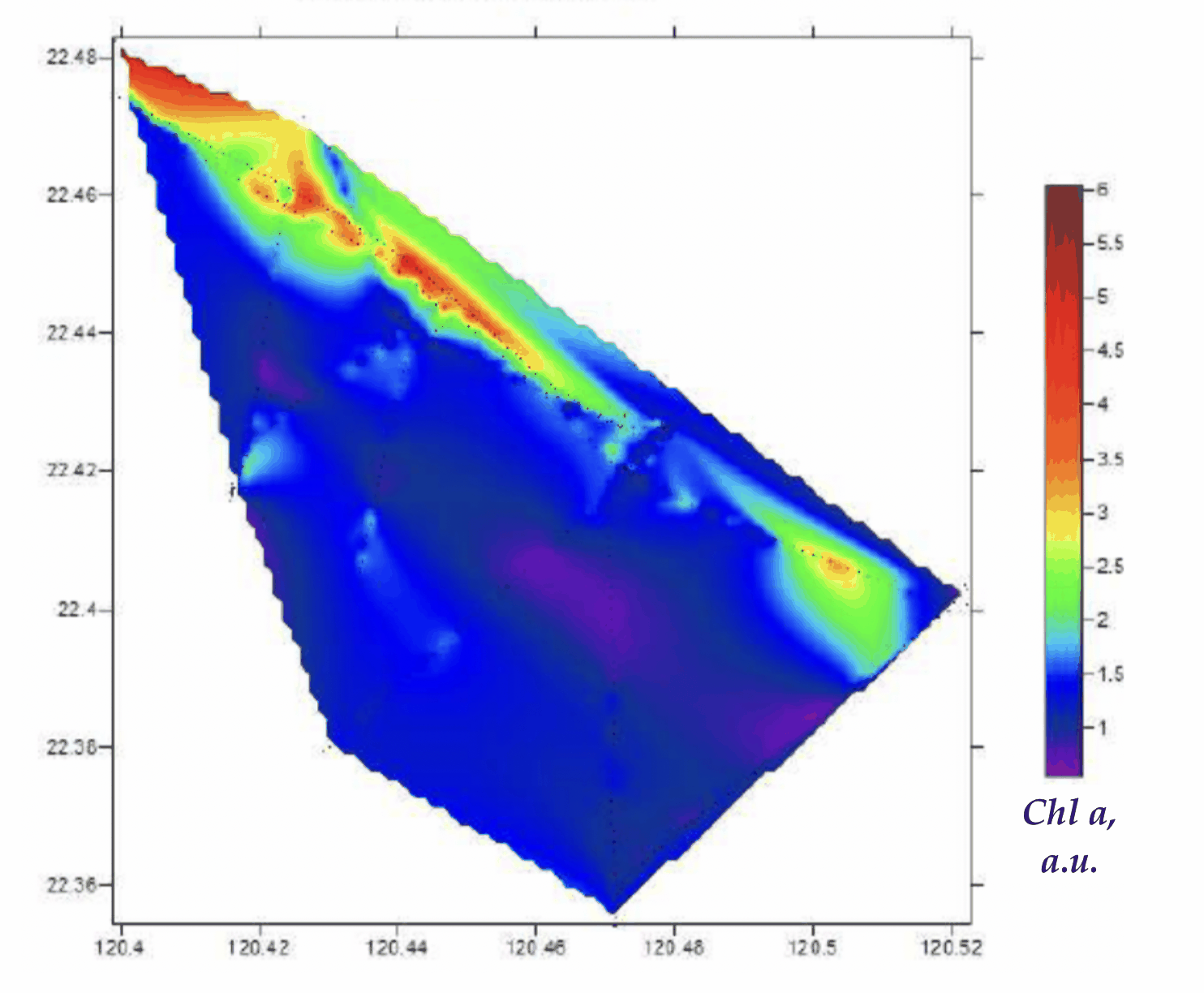
Interpolated chlorophyll a field mapped along the lidar track, Taiwan Strait, 2009 campaign
Fig. 1Chlorophyll a
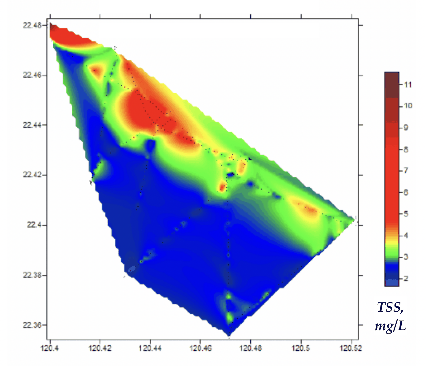
Interpolated total suspended solids field mapped along the lidar track, Taiwan Strait, 2009 campaign
Fig. 2TSS
Taiwan StraitPacific Ocean
1 km
● Taiwan Strait 2009, 2009-02-17 → 2009-02-18521 measurements IDW interpolation, 521 samples
Chl-a1.729.17µg/L

Fig. 3 Campaign scan. 521 lidar returns along the ship track, switchable across Chl-a. Field view interpolates the channel across the surveyed water from the same measurements (inverse-distance weighting). Shoreline: Natural Earth.

The Taiwan Strait is a shallow, current-swept channel between Taiwan and the Asian mainland, with coastal water shaped by river discharge, monsoon forcing and a busy shelf. In February 2009 a LIF LiDAR ran a short transect off the south-western coast, a small but distinct dataset, and the only entry in the archive from the western Pacific.

The value of the campaign is reach rather than density: it puts the same active fluorescence method to work in a sub-tropical Case-2 setting, well outside the European, Black Sea and Arctic waters that make up most of the record. A single strait transect of this kind is a useful marker of where the technique has been carried and how it behaves in an unfamiliar coastal regime.