Patos Lagoon coastal plume survey

A three-day survey at the mouth of Patos Lagoon, with 79,387 measurements used to examine a sediment-bearing coastal plume

Published figures

Interpolated campaign fields, reproduced in their original published form.

Plume composite

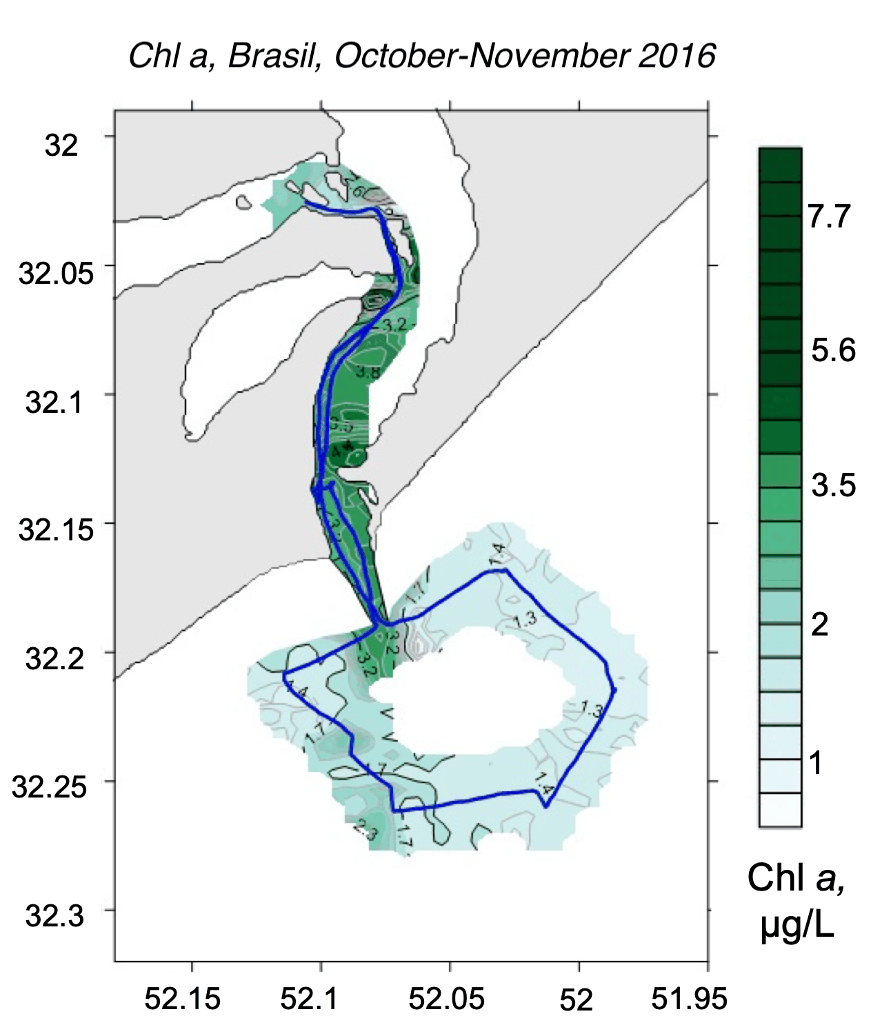
Interpolated chlorophyll a field mapped along the lidar track, Patos Lagoon mouth, Brazil, Plume composite
Fig. 1Chlorophyll a
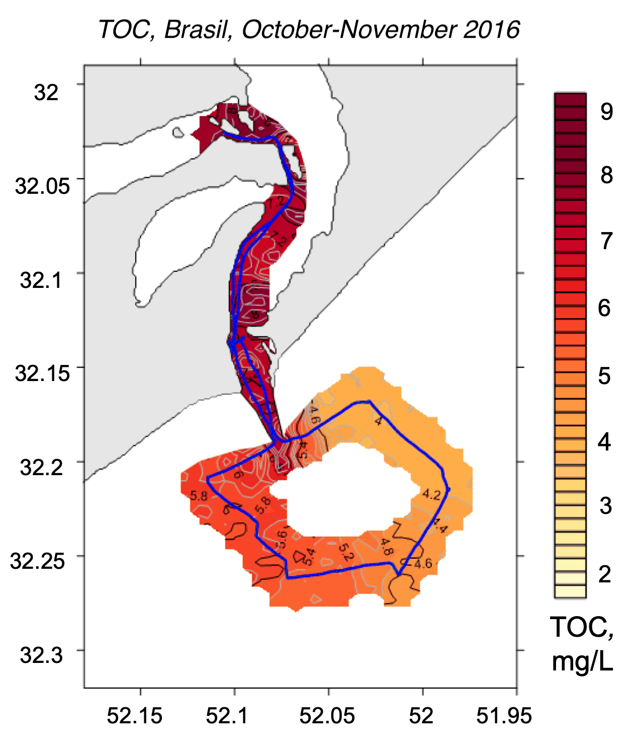
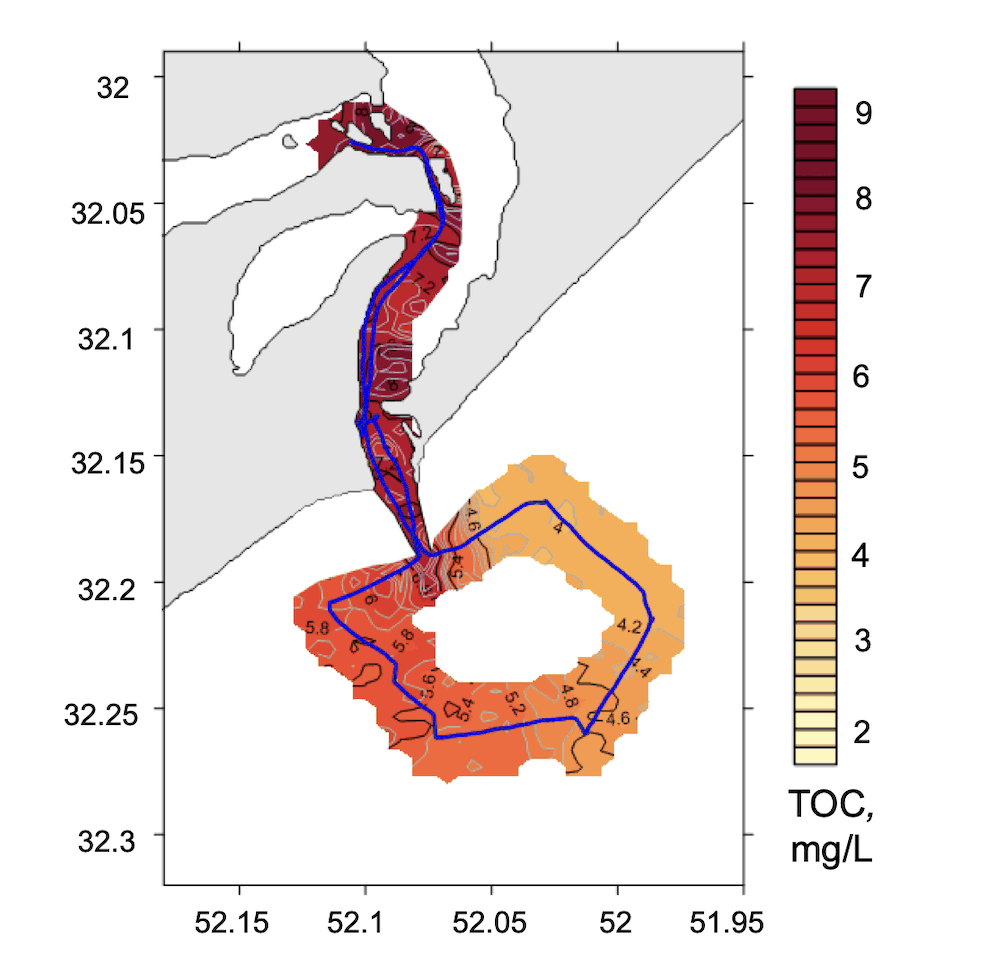
Interpolated total organic carbon field mapped along the lidar track, Patos Lagoon mouth, Brazil, Plume composite
Fig. 2TOC
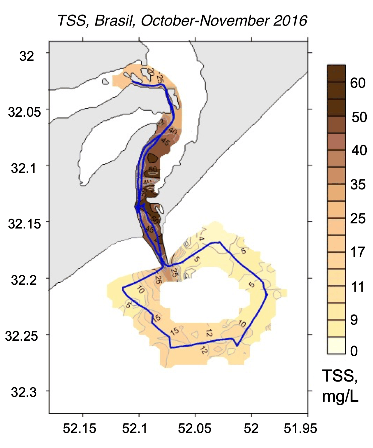
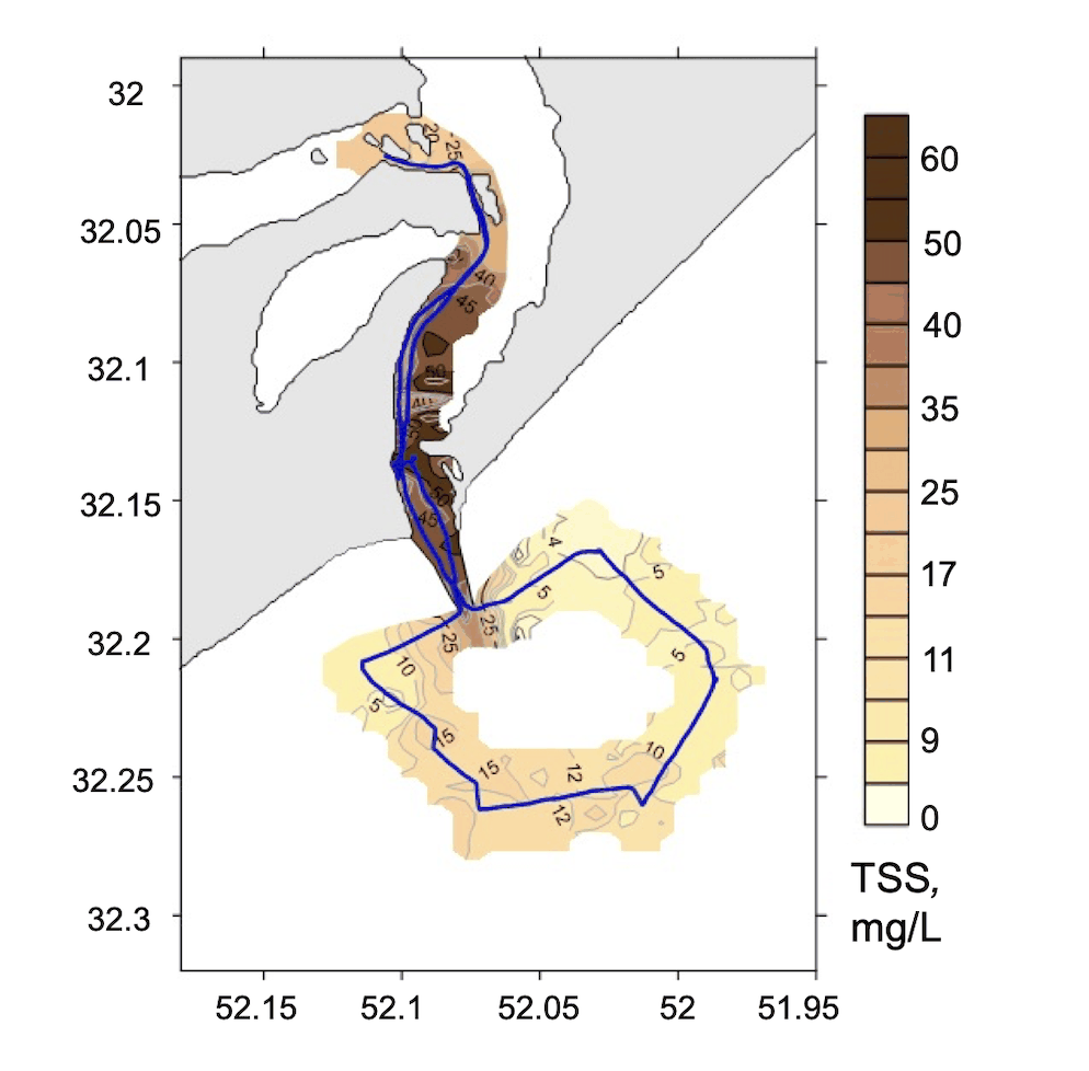
Interpolated total suspended matter field mapped along the lidar track, Patos Lagoon mouth, Brazil, Plume composite
Fig. 3TSM

2016 campaign

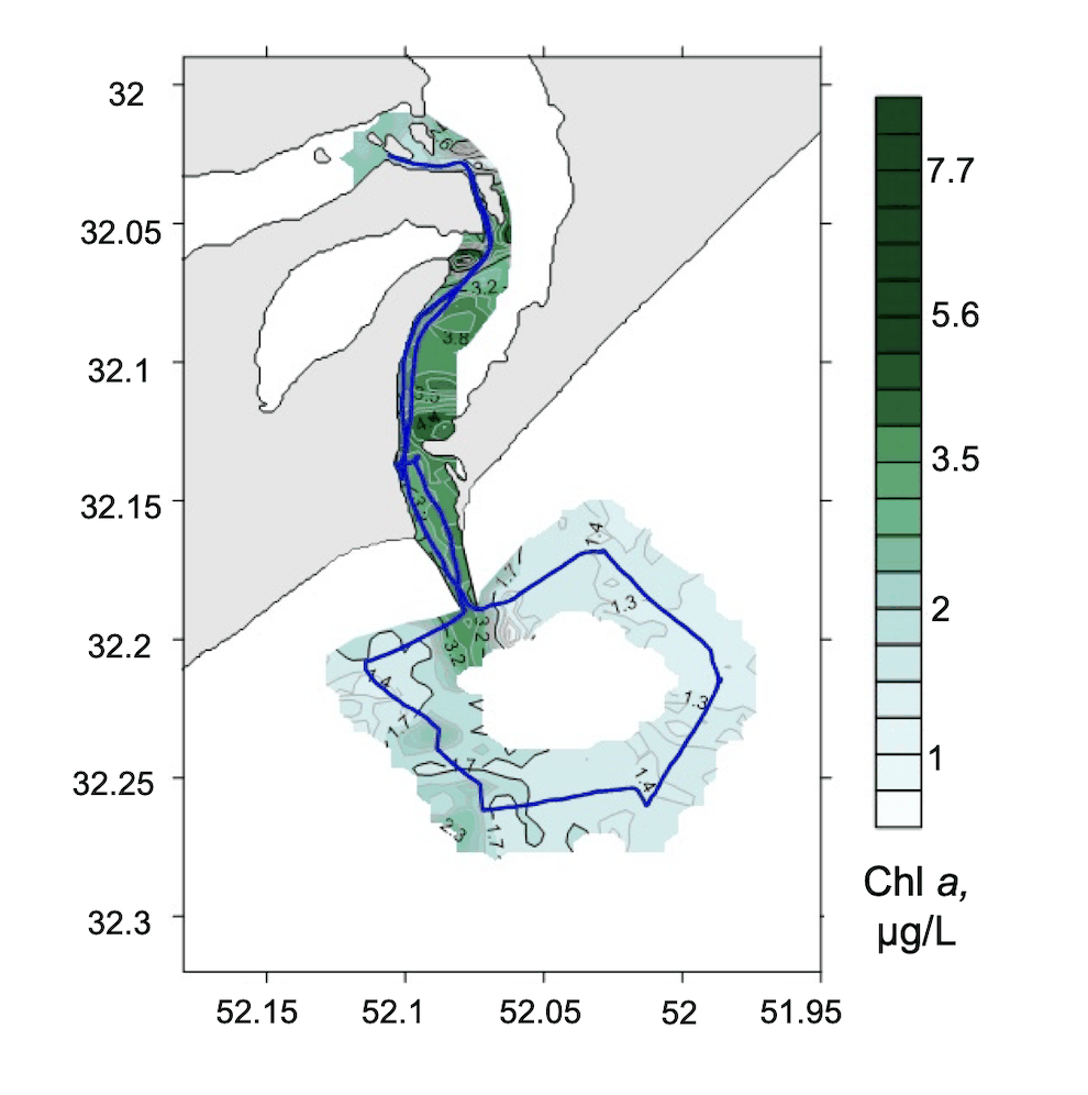
Interpolated chlorophyll a field mapped along the lidar track, Patos Lagoon mouth, Brazil, 2016 campaign
Fig. 4Chlorophyll a
Interpolated total organic carbon field mapped along the lidar track, Patos Lagoon mouth, Brazil, 2016 campaign
Fig. 5TOC
Interpolated total suspended matter field mapped along the lidar track, Patos Lagoon mouth, Brazil, 2016 campaign
Fig. 6TSM
Patos LagoonSouth Atlantic
2 km
● Patos Lagoon, 2016-11-30 – 2016-12-0263,586 measurements IDW interpolation, 600 samples
Chl-a0.896.55µg/L
CDOM0.140.61a.u.
TSM0.8522.9mg/L

Fig. 7 Campaign measurement record. 63,586 lidar returns are plotted along the vessel track for Chl-a, CDOM, TSM. The field view applies inverse-distance weighting to the same observations; the shoreline is from OpenStreetMap.

At the mouth of Patos Lagoon on the southern Brazilian coast, a three-day field survey produced 79,387 simultaneous determinations of suspended matter and organic content. The resulting record was used to examine fine-scale structure and short-term variability within a sediment-bearing coastal plume.

The campaign included collaborators from Brazil’s Universidade Federal do Rio Grande. The results were published in Estuarine, Coastal and Shelf Science in 2018.