Survey, 2021-06-06, Norwegian Sea

Nordic seas 2021, Baltic to Barents transit

An eleven-day delivery transit in June 2021 carried a LIF LiDAR from the western Baltic up the Norwegian coast to the Barents and White seas, logging roughly 900,000 returns across four contrasting basins. A single instrument captured the step from brackish, productive Baltic water to the clear Atlantic inflow of the Norwegian Sea and back to river-influenced sub-Arctic shelf.

Published figures

Interpolated fields from the campaign, reproduced as issued. Plate titles carry the LIFL-9 under its original designation, UFL-9.

Five-sea composite

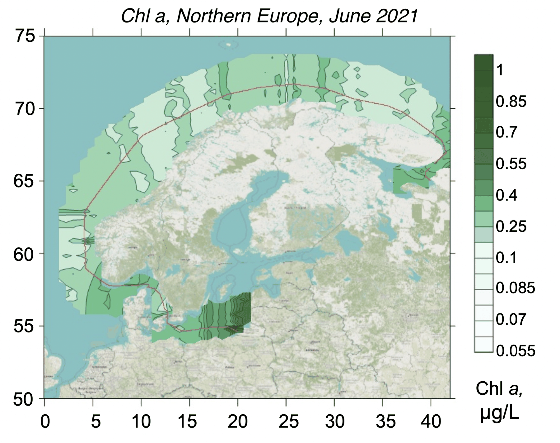
Interpolated chlorophyll a field mapped along the lidar track, Baltic, North, Norwegian, Barents seas, Five-sea composite
Fig. 1Chlorophyll a
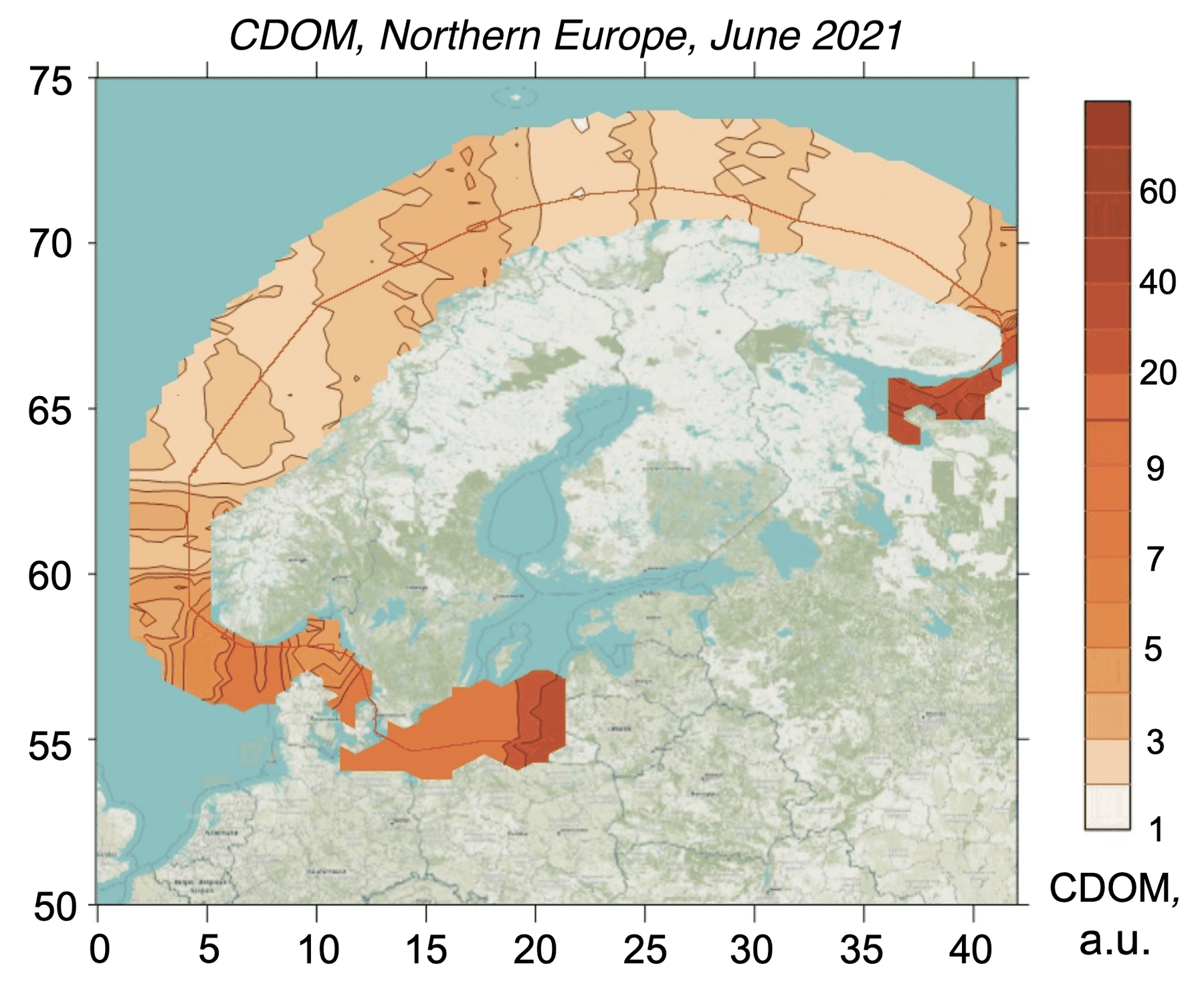
Interpolated CDOM field mapped along the lidar track, Baltic, North, Norwegian, Barents seas, Five-sea composite
Fig. 2CDOM
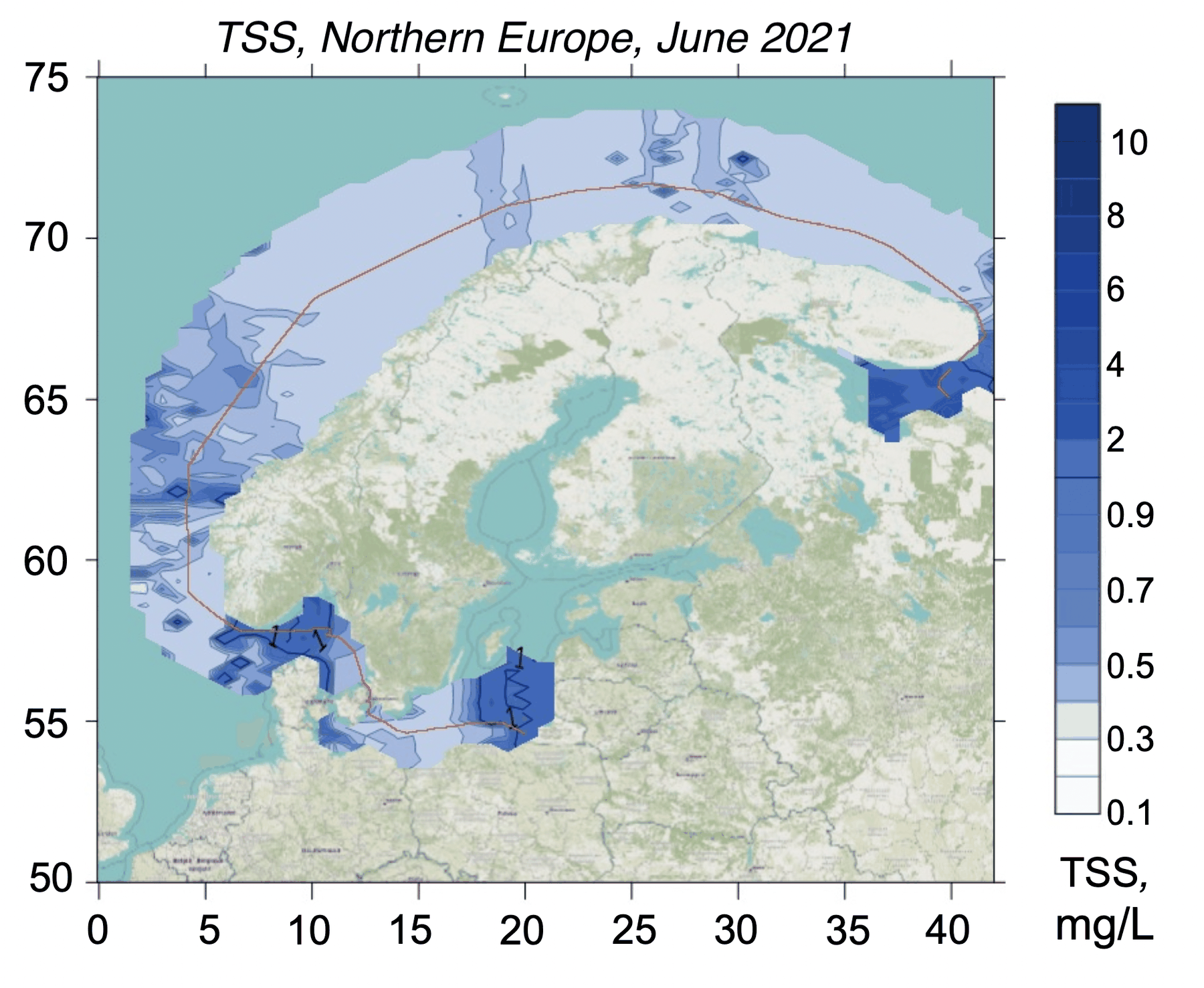
Interpolated total suspended solids field mapped along the lidar track, Baltic, North, Norwegian, Barents seas, Five-sea composite
Fig. 3TSS

Baltic leg

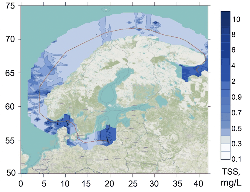
Interpolated total suspended solids field mapped along the lidar track, Baltic, North, Norwegian, Barents seas, Baltic leg
Fig. 4TSS
Norwegian SeaNorwegian Sea
100 km
● Norwegian Sea 2021, 2021-06-10 → 2021-06-14290,258 measurements IDW interpolation, 600 samples
Chl-a0.020.21µg/L
CDOM0.080.21a.u.
TSS0.292.48mg/L

Fig. 5 Campaign scan. 290,258 lidar returns along the ship track, switchable across Chl-a, CDOM, TSS. Field view interpolates the channel across the surveyed water from the same measurements (inverse-distance weighting). Shoreline: Natural Earth.

Between 6 and 17 June 2021 a ship-mounted LIF LiDAR ran continuously along a northbound transit through the western Baltic, across the North Sea, up the Norwegian Sea and into the Barents and White seas. The four legs together hold close to 900,000 returns, making the campaign a natural cross-section of north European water types measured by one sensor under uniform calibration.

The optical contrast along the route is large: surface chlorophyll near 0.5 µg/L in the productive western Baltic, falling below 0.1 µg/L in the oligotrophic Atlantic water entering the Norwegian Sea, then rising again on the river-charged Barents and White Sea shelves. Continuous transects of this kind, one platform, one method, many regimes, are the substrate for building and checking the regional retrieval models that ocean-colour cal/val depends on.