Survey, 2010-05-27, Black Sea

North-eastern Black Sea 2010, Sochi shelf

A May 2010 LIF LiDAR survey of the north-eastern Black Sea shelf off Sochi, 15,004 returns over a steep, narrow continental margin where river and coastal inputs raise suspended matter against otherwise clear sub-tropical sea water.

Published figures

Interpolated fields from the campaign, reproduced as issued. Plate titles carry the LIFL-9 under its original designation, UFL-9.

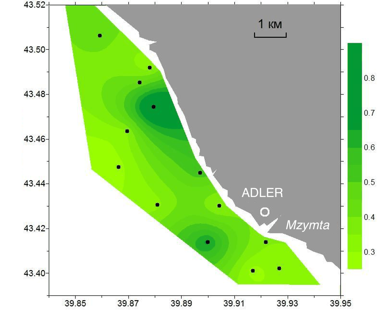
Interpolated chlorophyll a field mapped along the lidar track, Sochi shelf, 27 May 2010
Fig. 1Chlorophyll a
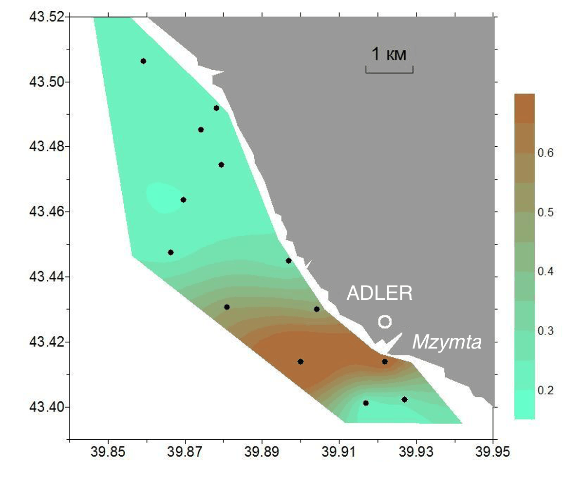
Interpolated CDOM field mapped along the lidar track, Sochi shelf, 27 May 2010
Fig. 2CDOM
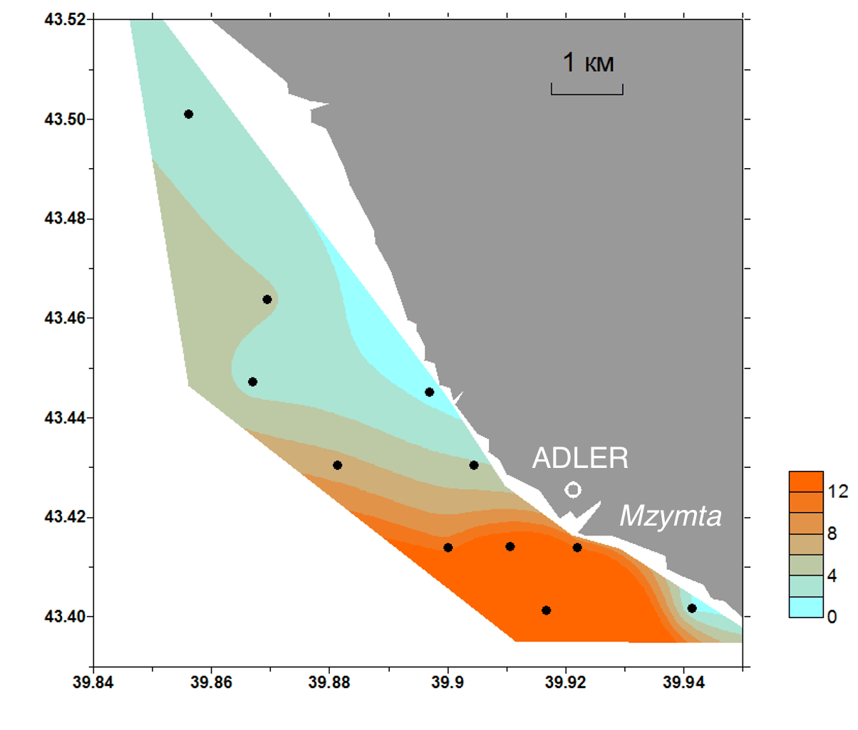
Interpolated total suspended solids field mapped along the lidar track, Sochi shelf, 27 May 2010
Fig. 3TSS
Sochi shelfBlack Sea
1 km
● NE Black Sea 2010, 2010-05-2715,004 measurements IDW interpolation, 600 samples
Chl-a0.310.81µg/L
CDOM0.000.74a.u.
TSS2.0824.1mg/L

Fig. 4 Campaign scan. 15,004 lidar returns along the ship track, switchable across Chl-a, CDOM, TSS. Field view interpolates the channel across the surveyed water from the same measurements (inverse-distance weighting). Shoreline: Natural Earth.

The north-eastern Black Sea has a steep, narrow shelf where the Caucasus coast drops quickly to deep water and small mountain rivers deliver pulses of sediment after rain. In May 2010 a LIF LiDAR ran a 15,004-point survey across the Sochi shelf, sampling chlorophyll a, CDOM and suspended matter along the coast.

Chlorophyll a runs near 0.45 µg/L over the shelf, with suspended matter the more variable channel, median around 3 mg/L but reaching well above 15 mg/L in the coastal band closest to river outflow. Resolving that nearshore-to-offshore gradient continuously is where a fast ship-mounted sensor outperforms the sparse station grids that conventional shelf monitoring relies on.