Survey, 2015-05-18, Black Sea

Kerch Strait, repeat strait transects

Repeat LIF LiDAR transects of the Kerch Strait, the narrow channel exchanging water between the Black Sea and the Sea of Azov. Two consecutive May 2015 surveys (about 23,000 and 16,000 returns) plus a 2020 revisit track the suspended-sediment and chlorophyll structure of a shallow, current-swept passage.

Published figures

Interpolated fields from the campaign, reproduced as issued. Plate titles carry the LIFL-9 under its original designation, UFL-9.

19 May 2015

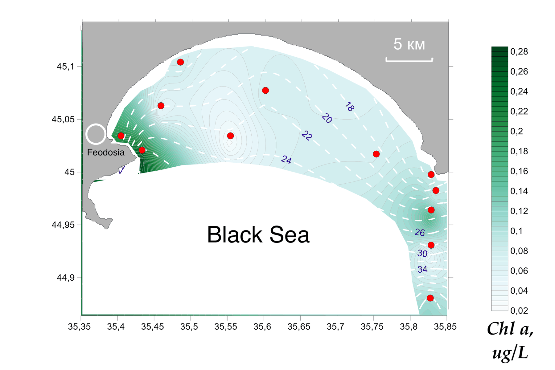
Interpolated chlorophyll a field mapped along the lidar track, Kerch Strait, 19 May 2015
Fig. 1Chlorophyll a
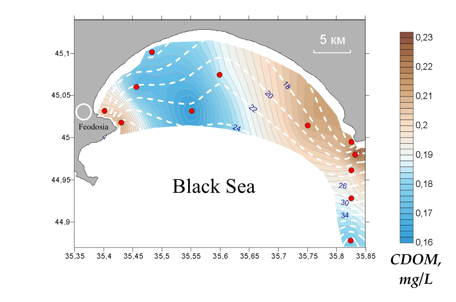
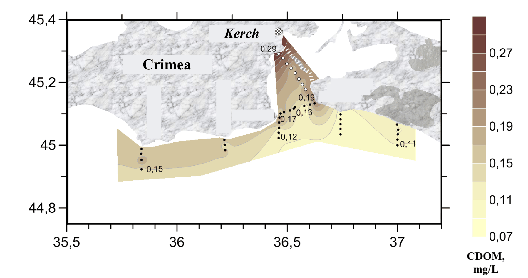
Interpolated CDOM field mapped along the lidar track, Kerch Strait, 19 May 2015
Fig. 2CDOM
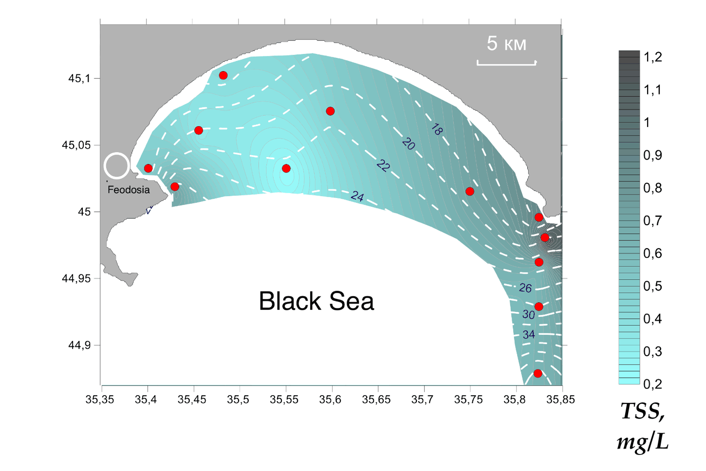
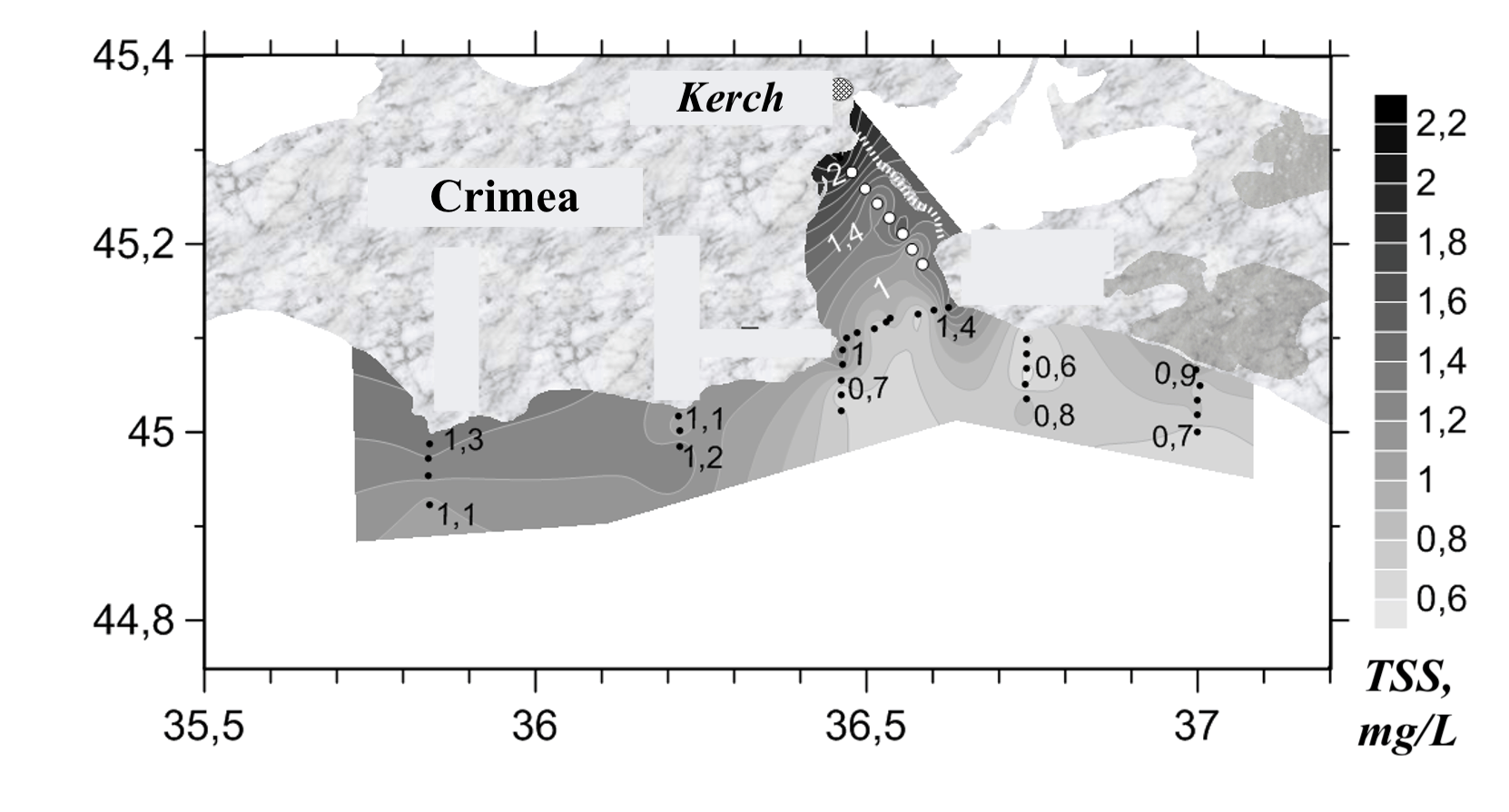
Interpolated total suspended solids field mapped along the lidar track, Kerch Strait, 19 May 2015
Fig. 3TSS

July 2020

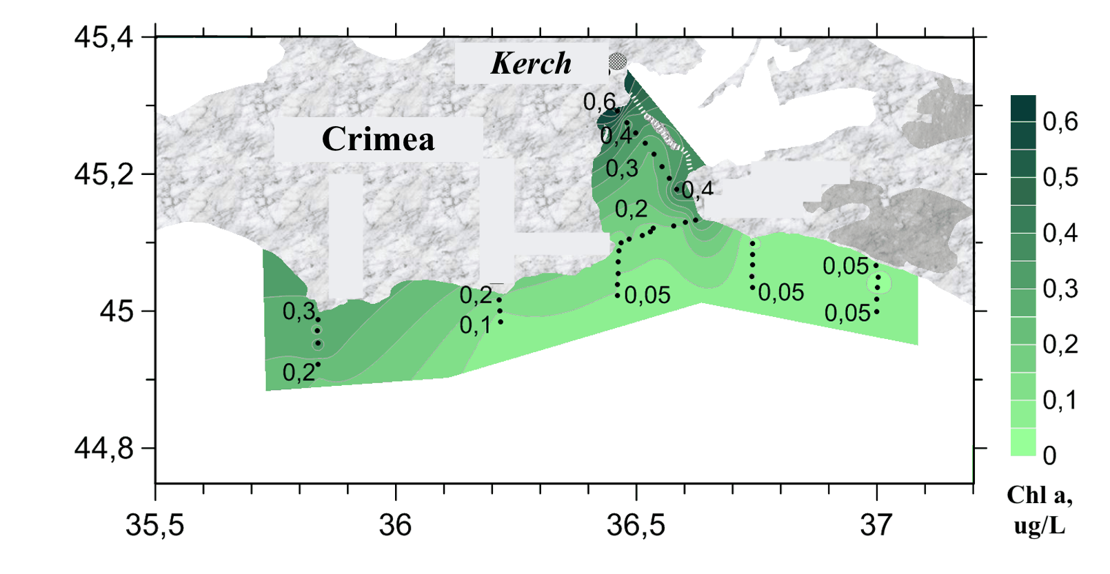
Interpolated chlorophyll a field mapped along the lidar track, Kerch Strait, July 2020
Fig. 4Chlorophyll a
Interpolated CDOM field mapped along the lidar track, Kerch Strait, July 2020
Fig. 5CDOM
Interpolated total suspended solids field mapped along the lidar track, Kerch Strait, July 2020
Fig. 6TSS
Kerch StraitBlack Sea
2 km
● Kerch Strait 2015, 2015-05-1823,329 measurements IDW interpolation, 600 samples
Chl-a0.030.20µg/L
CDOM0.090.69a.u.
TSS0.329.64mg/L

Fig. 7 Campaign scan. 23,329 lidar returns along the ship track, switchable across Chl-a, CDOM, TSS. Field view interpolates the channel across the surveyed water from the same measurements (inverse-distance weighting). Shoreline: Natural Earth.

The Kerch Strait is a shallow, narrow channel through which Black Sea and Azov water exchange, with strong currents and a mobile bed that keep suspended matter in constant motion. A LIF LiDAR transected the strait on consecutive days in May 2015, about 23,000 and 16,000 returns, and returned in July 2020, building a small repeat-survey set over a setting where conditions change hour to hour.

Chlorophyll a is low and stable across the strait, near 0.08 µg/L, while suspended matter carries the spatial signal, peaking around the shoals and channel margins. Repeat transects along the same line on adjacent days show how much of that structure is fixed by bathymetry and how much shifts with the flow, the kind of short-term variability a single station cannot capture.