Survey, 2020-09-27, Arctic Ocean

Arctic 2020, Northern Sea Route transit

A full Northern Sea Route transit logged continuously by ship-mounted LIF LiDAR, roughly 864,000 returns from late September to early November 2020 across the Kara, Laptev and East Siberian seas, the company's single largest field dataset. Constituent concentrations span three orders of magnitude, from near-zero chlorophyll in the open Arctic to river-charged shelf water off the Ob and in the White Sea.

Published figures

Interpolated fields from the campaign, reproduced as issued. Plate titles carry the LIFL-9 under its original designation, UFL-9.

Kara Sea leg

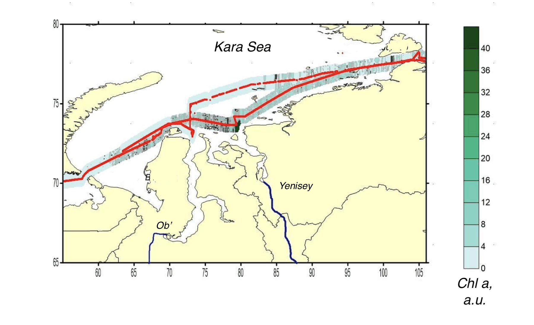
Interpolated chlorophyll a field mapped along the lidar track, Kara, Laptev, East Siberian seas, Kara Sea leg
Fig. 1Chlorophyll a
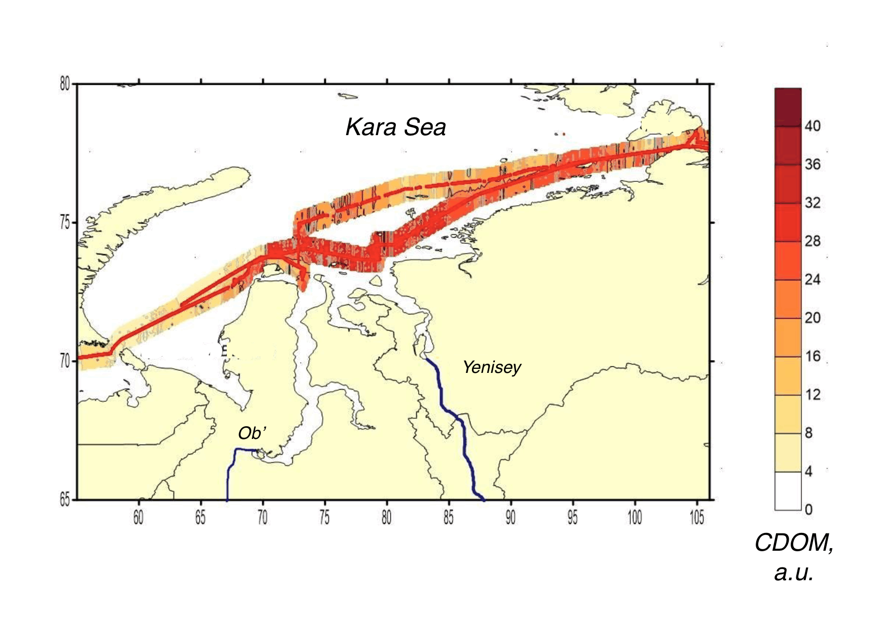
Interpolated CDOM field mapped along the lidar track, Kara, Laptev, East Siberian seas, Kara Sea leg
Fig. 2CDOM
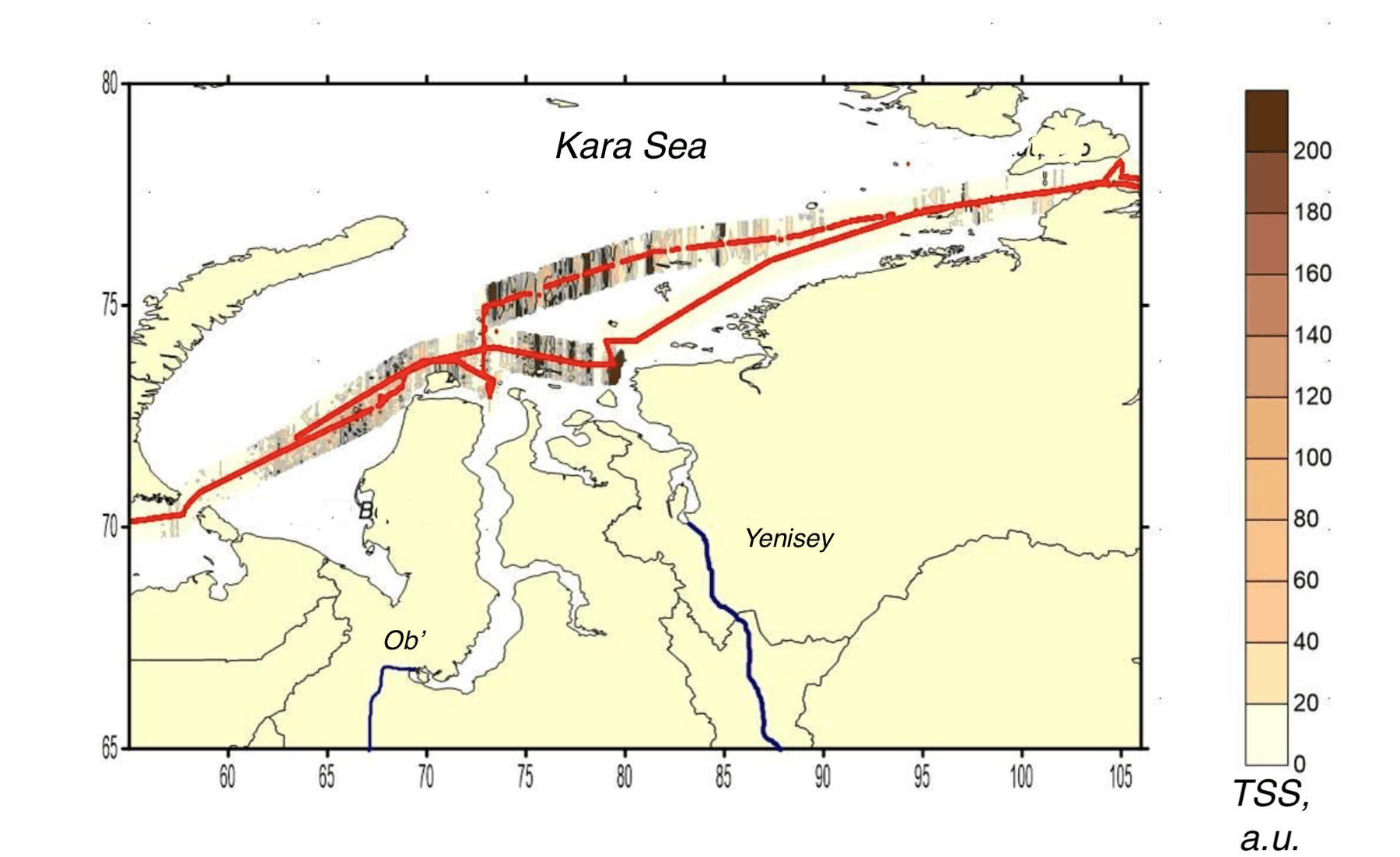
Interpolated total suspended solids field mapped along the lidar track, Kara, Laptev, East Siberian seas, Kara Sea leg
Fig. 3TSS

Laptev Sea leg

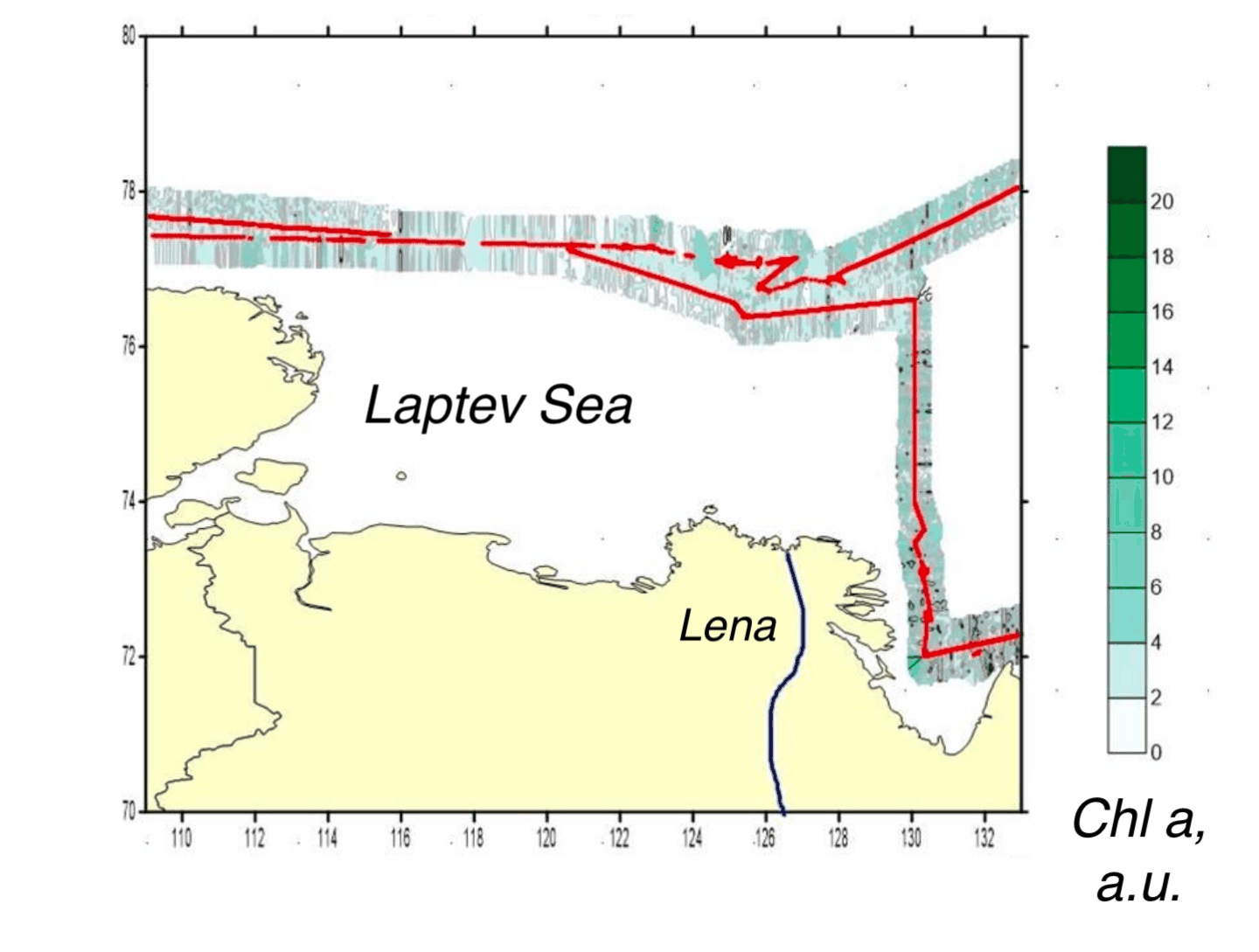
Interpolated chlorophyll a field mapped along the lidar track, Kara, Laptev, East Siberian seas, Laptev Sea leg
Fig. 4Chlorophyll a
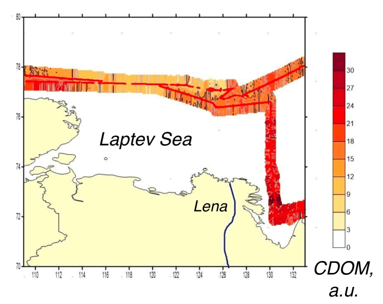
Interpolated CDOM field mapped along the lidar track, Kara, Laptev, East Siberian seas, Laptev Sea leg
Fig. 5CDOM
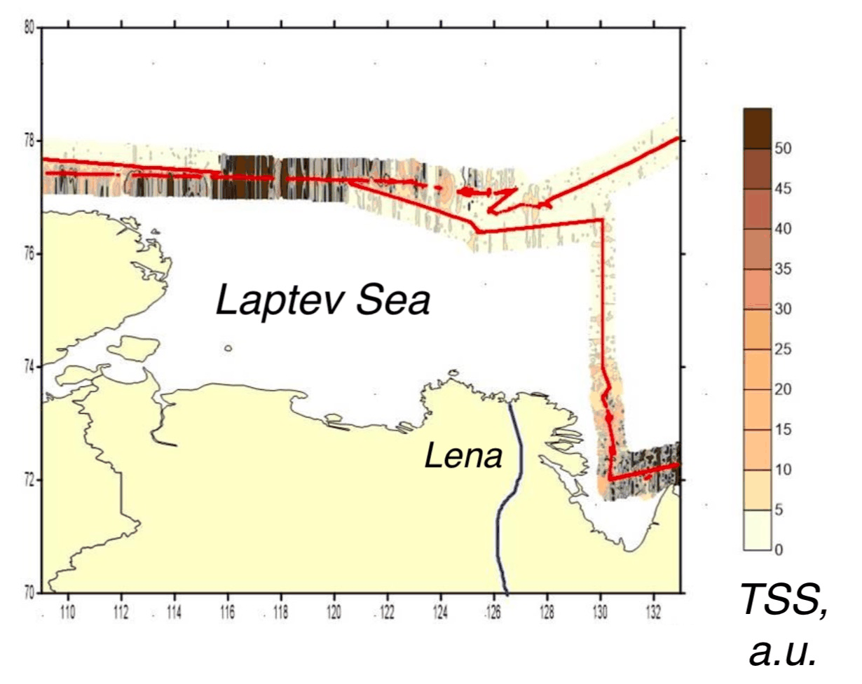
Interpolated total suspended solids field mapped along the lidar track, Kara, Laptev, East Siberian seas, Laptev Sea leg
Fig. 6TSS

East Siberian Sea leg

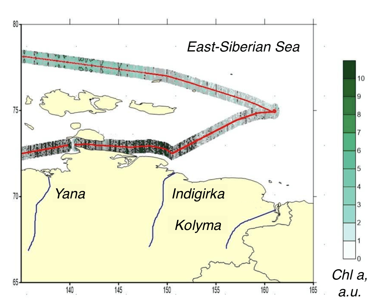
Interpolated chlorophyll a field mapped along the lidar track, Kara, Laptev, East Siberian seas, East Siberian Sea leg
Fig. 7Chlorophyll a
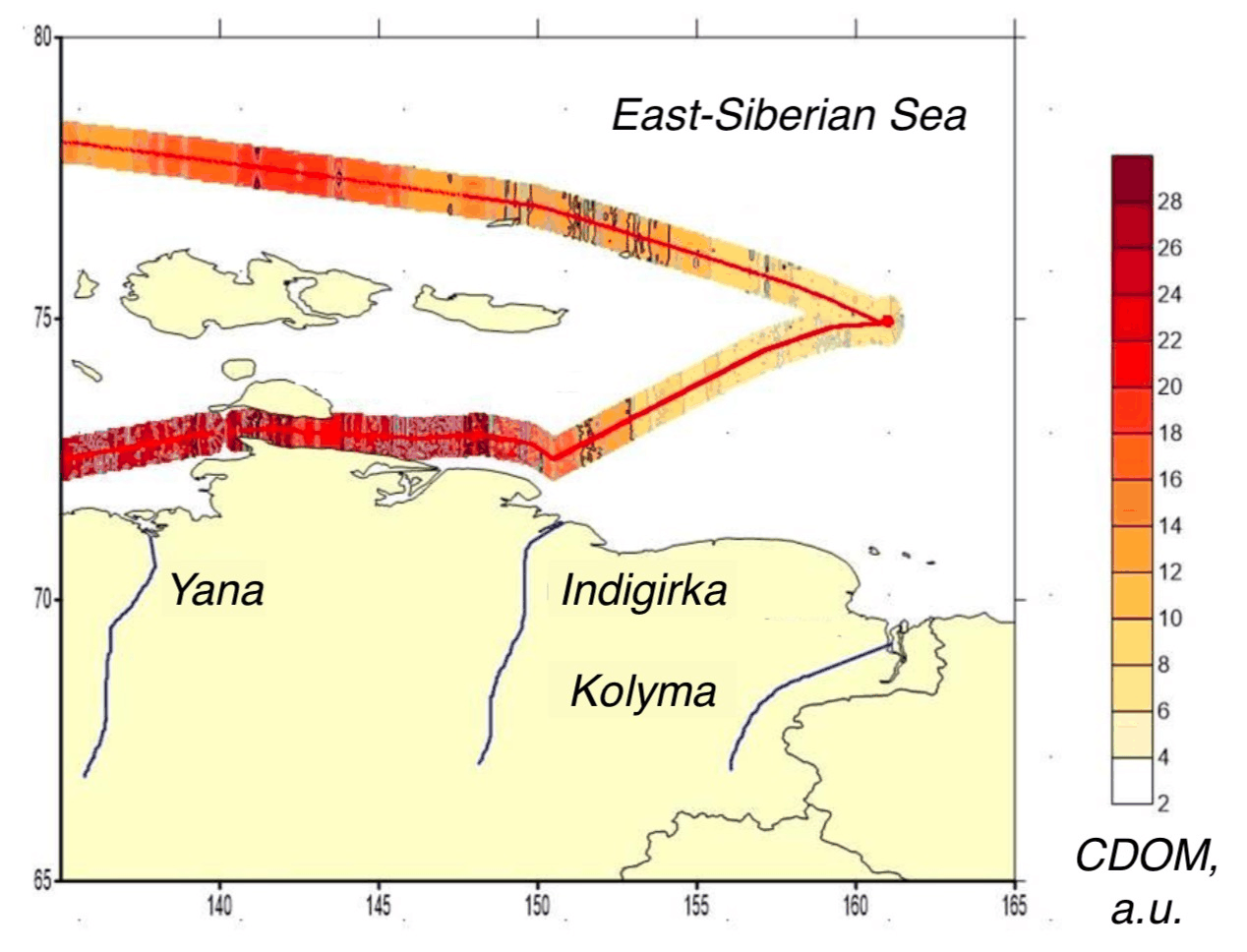
Interpolated CDOM field mapped along the lidar track, Kara, Laptev, East Siberian seas, East Siberian Sea leg
Fig. 8CDOM
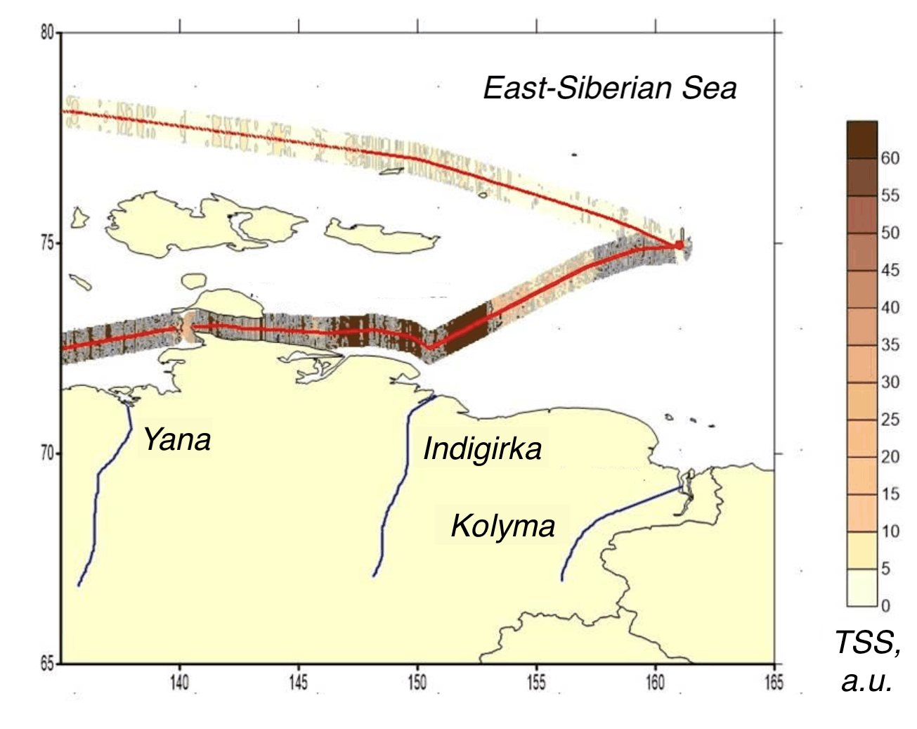
Interpolated total suspended solids field mapped along the lidar track, Kara, Laptev, East Siberian seas, East Siberian Sea leg
Fig. 9TSS

White Sea leg

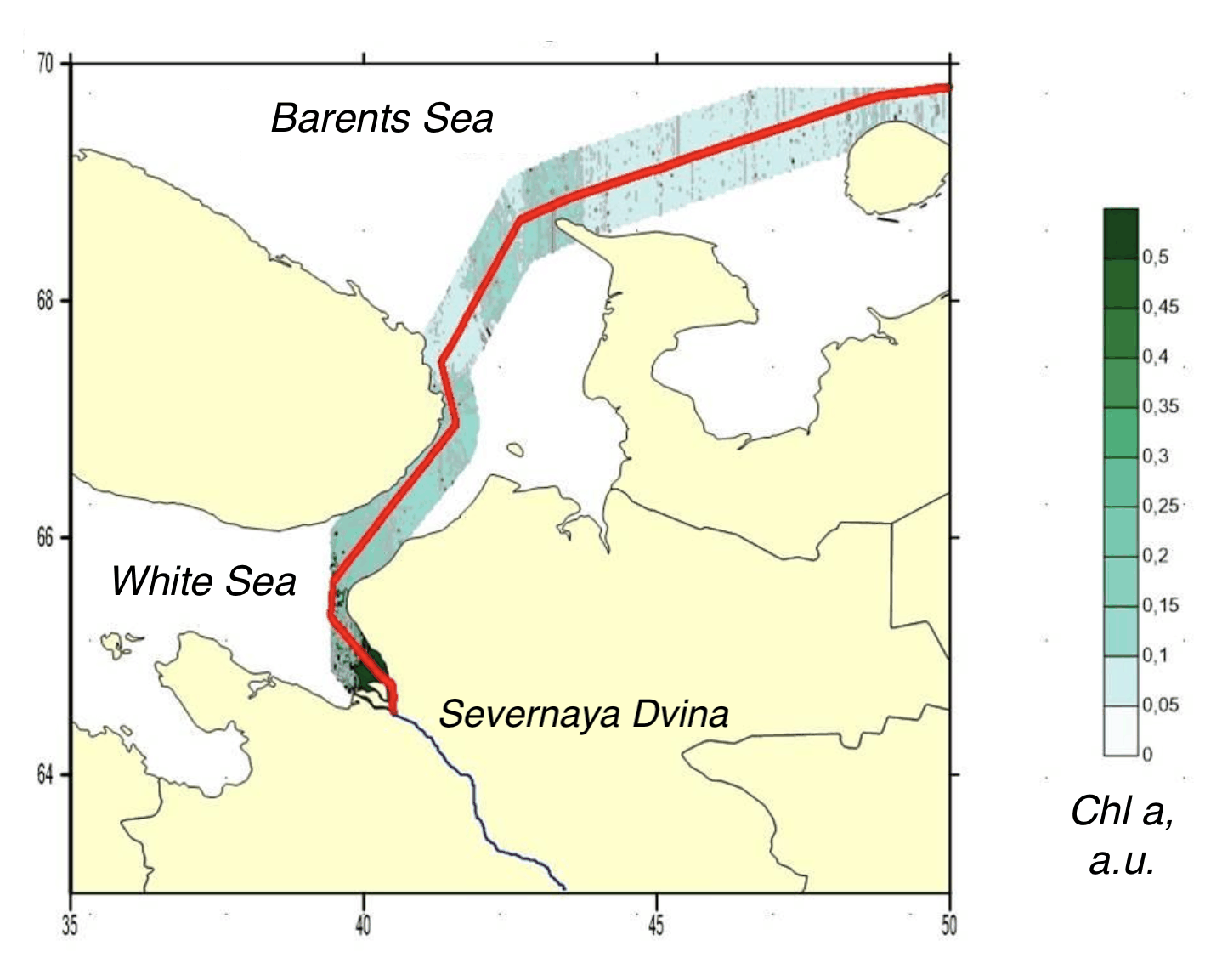
Interpolated chlorophyll a field mapped along the lidar track, Kara, Laptev, East Siberian seas, White Sea leg
Fig. 10Chlorophyll a
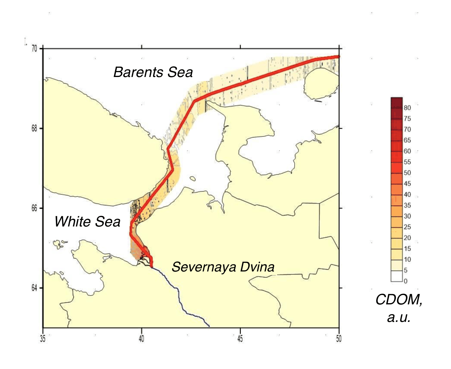
Interpolated CDOM field mapped along the lidar track, Kara, Laptev, East Siberian seas, White Sea leg
Fig. 11CDOM
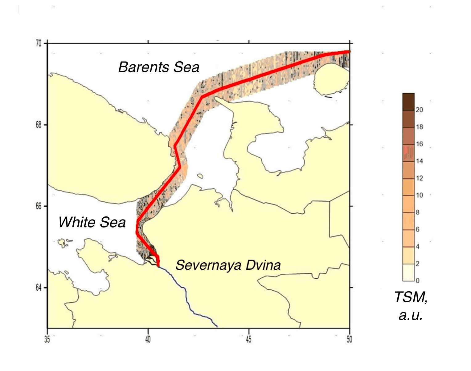
Interpolated total suspended matter field mapped along the lidar track, Kara, Laptev, East Siberian seas, White Sea leg
Fig. 12TSM
Kara → East Siberian SeaArctic Ocean
200 km
● Arctic 2020, Northern Sea Route, 2020-10-15 → 2020-10-29522,614 measurements IDW interpolation, 600 samples, track swath
Chl-a0.012.60µg/L
CDOM0.281.26a.u.
TSS0.3641.5mg/L

Fig. 13 Campaign scan. 522,614 lidar returns along the ship track, switchable across Chl-a, CDOM, TSS. Field view interpolates the channel across the surveyed water from the same measurements (inverse-distance weighting). Shoreline: Natural Earth.

Over six weeks in autumn 2020 a LIF LiDAR ran unattended along a Northern Sea Route transit, sampling the shelf seas of the Russian Arctic from the Barents and Kara in the west to the East Siberian Sea in the east. The legs together hold about 864,000 returns, by some margin the densest record in the expedition archive, collected through the full range of late-season Arctic light and weather that the method is built to tolerate.

The transit crosses sharp optical boundaries that point sampling smears. Chlorophyll a falls below 0.01 µg/L in the clearest open-water legs, while the Ob estuary and the White Sea carry the coloured-dissolved-organic and suspended-sediment signatures of large river discharge. Resolving those gradients continuously, at speed, in ice-edge conditions is the operational case for active fluorescence sensing in the polar ocean.