Survey, 2018-08-29, Black Sea

Abkhazia 2018, eastern Black Sea coast

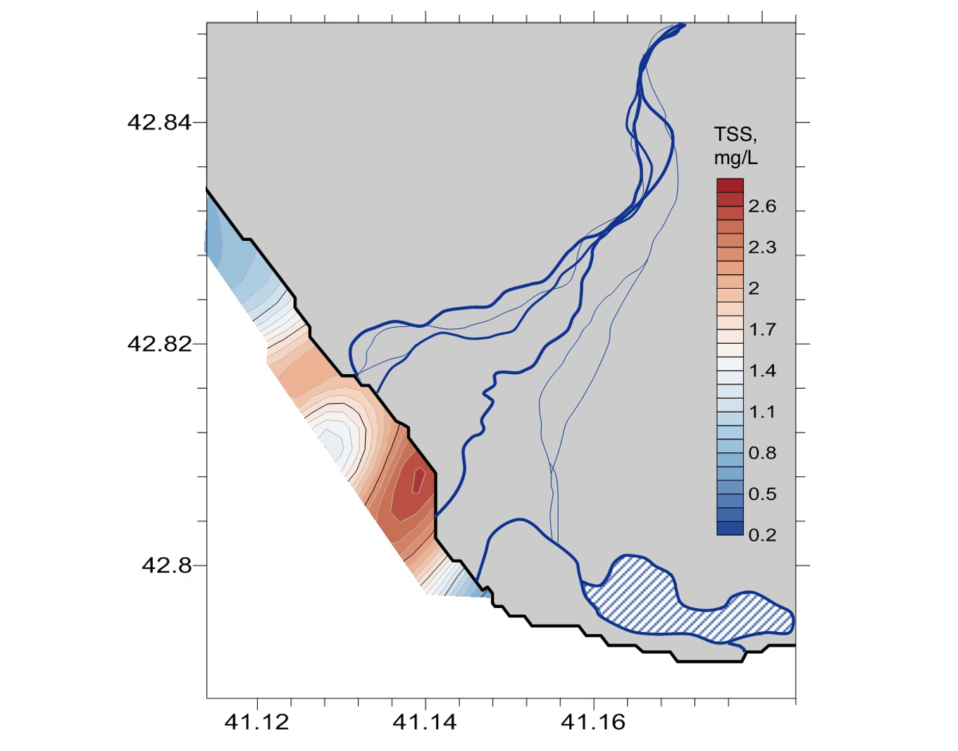
A LIF LiDAR survey on the Abkhazian coast, mapping chlorophyll a, CDOM and suspended matter along a three-kilometre strip of nearshore water beside a braided river delta. Suspended matter alone spans 0.2 to 2.6 mg/L inside that strip.

Published figures

Interpolated fields from the campaign, reproduced as issued. Plate titles carry the LIFL-9 under its original designation, UFL-9.

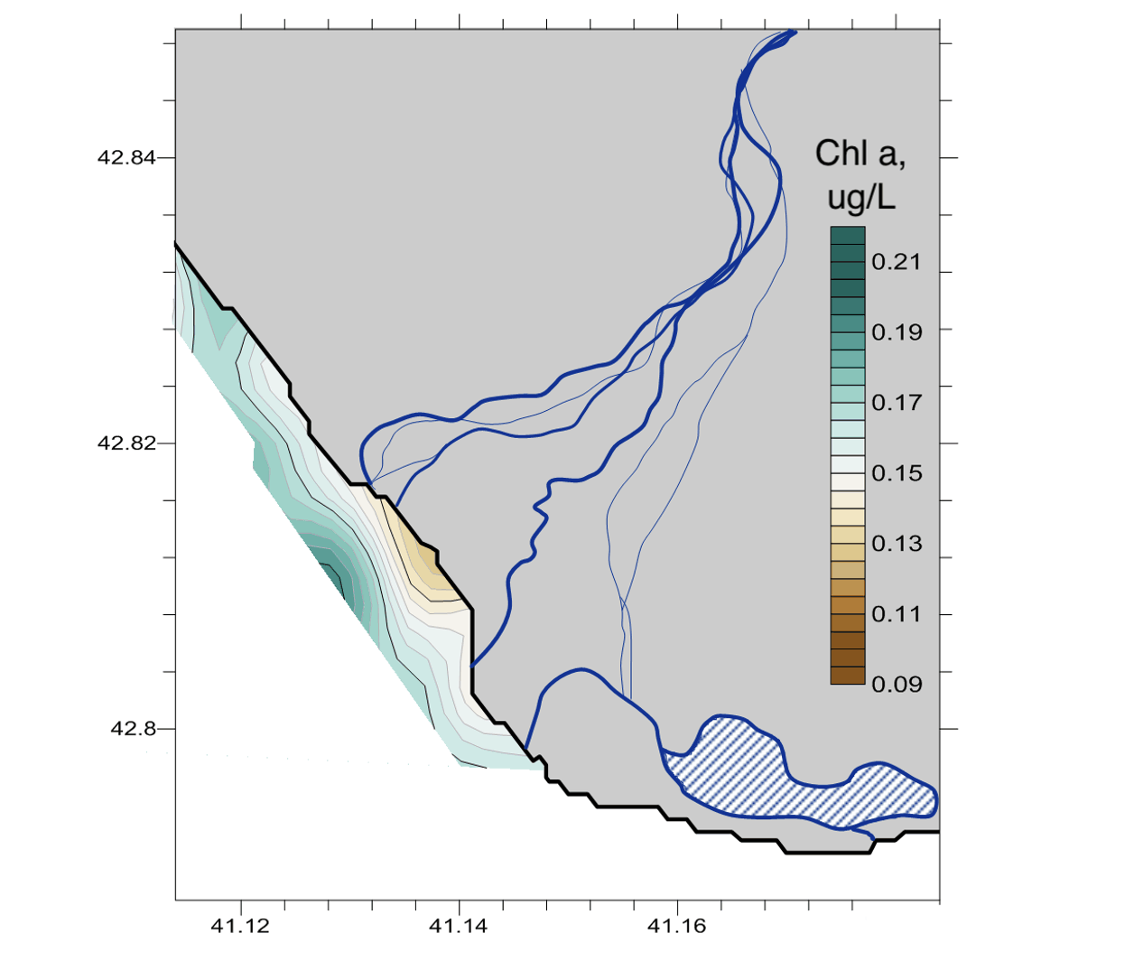
Interpolated chlorophyll a field along a three-kilometre nearshore strip, Abkhazian coast, 29 August 2018
Fig. 1Chlorophyll a
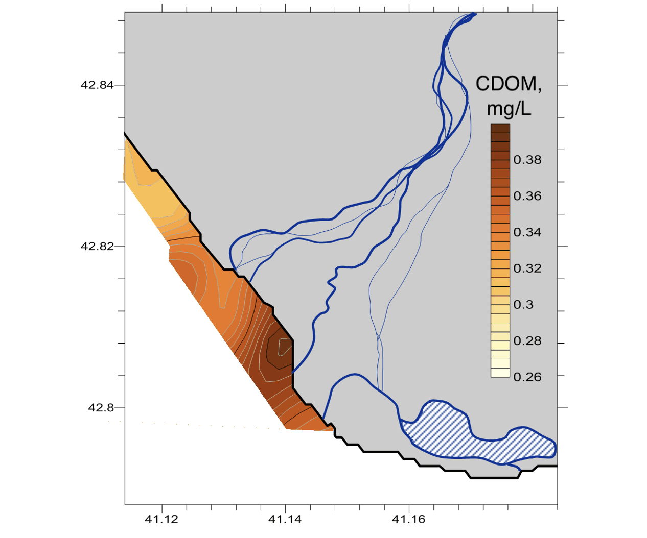
Interpolated CDOM field along a three-kilometre nearshore strip, peaking beside the river delta, Abkhazian coast, 29 August 2018
Fig. 2CDOM
Interpolated total suspended solids field along a three-kilometre nearshore strip, peaking beside the river delta, Abkhazian coast, 29 August 2018
Fig. 3TSS

The eastern Black Sea coast takes short, steep rivers off the western Caucasus, and they reach the sea through braided channels across a low delta. On 29 August 2018 a LIF LiDAR mapped a three-kilometre strip of water alongshore of one of those deltas, reading chlorophyll a, CDOM and suspended matter on the same pass.

Chlorophyll a stays between 0.09 and 0.21 µg/L across the strip, closer to open Black Sea water than to a productive estuary. CDOM and suspended matter both peak at the south-eastern end nearest the delta, suspended matter running from 0.2 mg/L at the far end to above 2.6 mg/L on the outflow, and chlorophyll is at its lowest exactly there. The river adds sediment and dissolved organic material while diluting the biology, a distinction three channels measured together can make and one cannot.